

PulseCloud: Your Hub for Drone Data Processing Projects
PulseCloud is SmartDrone’s cloud-based project management and data delivery platform. Upload raw drone data, request processing quotes, track project progress, securely store project files, and access final deliverables, all from a single workspace.
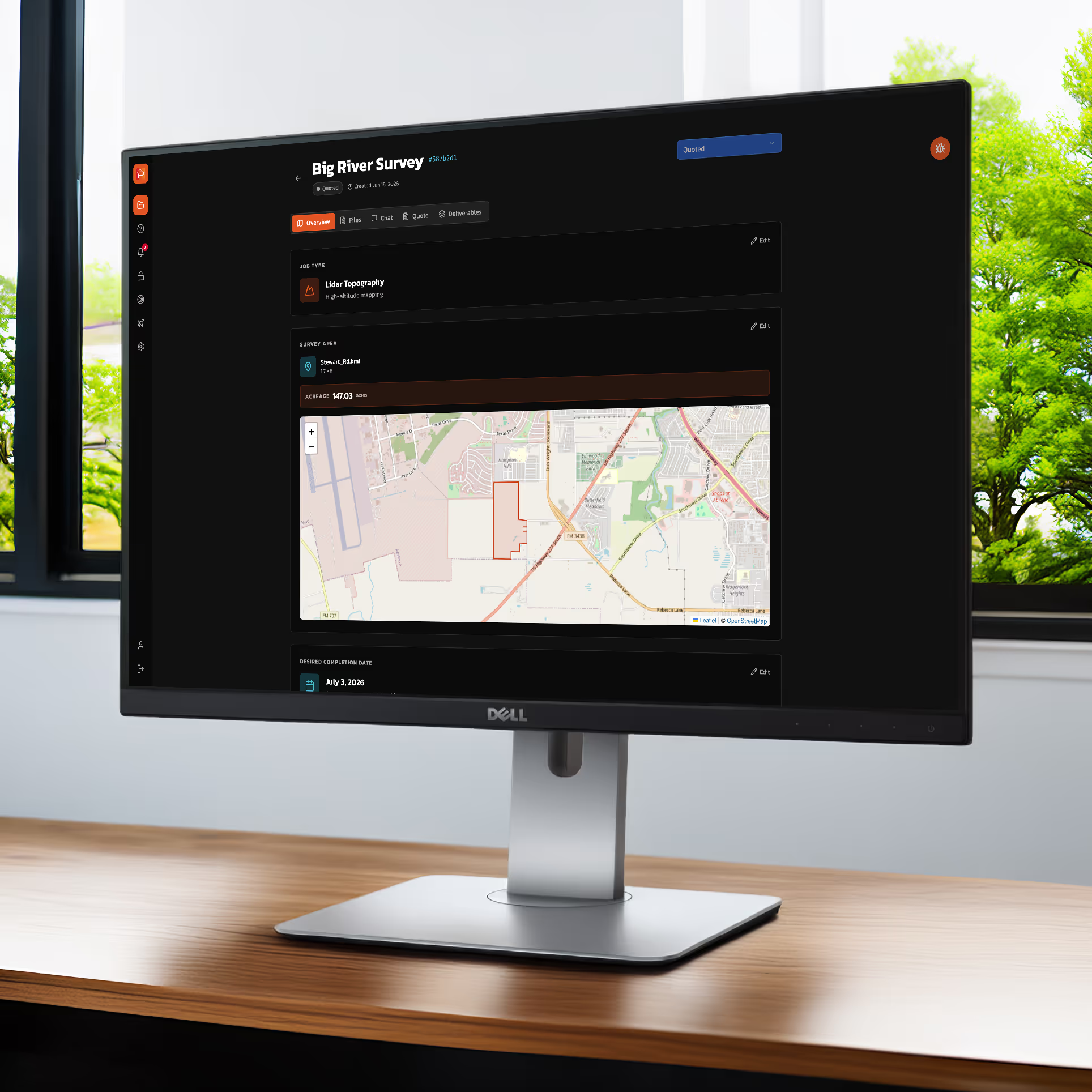
Submit Bids Faster. Win More Jobs.
Every project is quoted before processing begins, giving you visibility into costs before work starts.
No Surprises
Know processing costs before work begins, so you can price projects with confidence and avoid unexpected expenses.
Fast Quoting
Receive most processing quotes within 8 hours of creating your project, helping you respond to opportunities and submit bids faster.
Pricing that Wins
We don’t win if you don’t win. Our processing rates are designed to help you submit competitive proposals, protect your margins, and confidently add drone deliverables to your projects.
Processing Made Simple
PulseCloud keeps every project moving with a simple, secure workflow. From requesting a processing quote to downloading your finished deliverables.
Request a Processing Quote
Receive a locked-in processing quote before bidding your project.
Upload Your Data
Securely upload your LiDAR and imagery after completing field work.
Expert Processing
Our U.S.-based experts process your data and perform quality assurance.
Download Your Deliverables
Download your completed deliverables in the formats you need.
Want to see the complete process?
Explore the full Membership workflow to see how onboarding, flight operations, processing, and deliverables work together from start to finish.
Processed by Geospatial Experts
Your data is processed by our ASPRS-certified team with extensive experience supporting surveying workflows and deliverables.
U.S.-Based Processing
Data never leaves the United States.
Survey-Focused Expertise
Built around surveying deliverables and workflows.
Consistent Output Standards
Standardized workflows guarantee high quality results.
Data Accuracy Reporting
Feel confident with per project accuracy reporting.

FAQs
Find answers to common questions about SmartDrone Membership and Ownership, including processing, support, flexibility, and choosing the right option for your survey firm.
PulseCloud is SmartDrone's cloud-based project and processing workflow.
Yes. Project data is stored and managed in the United States.
Deliverables can include classified point clouds, contours, orthomosaics, surfaces, and other survey-ready outputs.
Your SmartDrone team will guide you through the upload and processing workflow.
Yes. Protecting customer data is a core part of the platform.
Experience Drone Surveying Without the Processing Burden
Expand your surveying capabilities while our U.S.-based geospatial experts handle the processing behind the scenes.